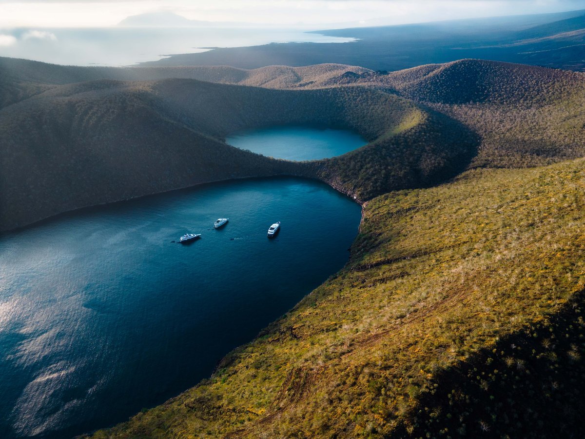
Scientists used high-resolution mapping technologies to find new hydrothermal vents and discover at least 15 unknown species in the Galapagos Marine Reserve
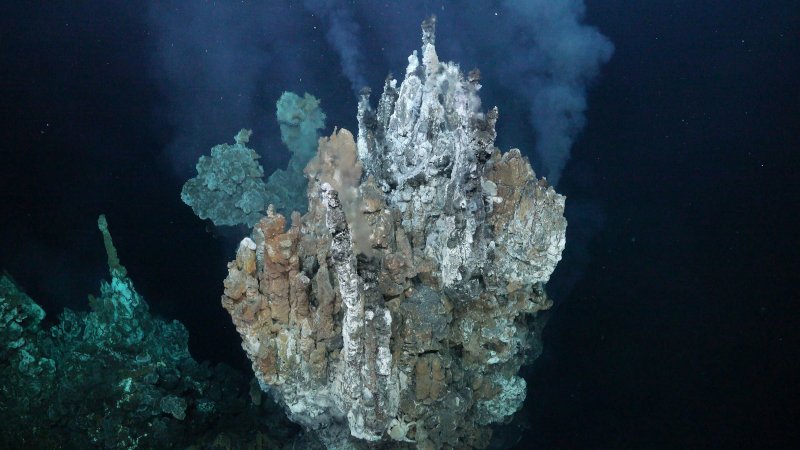
An international team of researchers aboard the Falkor (too), the scientific vessel of the Schmidt Ocean Institute (SOI), discovered a new hydrothermal vent field named "Tortugas." This field, located north of Pinta Island, extends over 600 meters along the western edge of the caldera floor of the Los Huellos submarine volcano in the Galapagos Marine Reserve. Cutting-edge mapping technologies rarely employed in scientific exploration were utilized to achieve this discovery.
This marks the second hydrothermal vent field found this year in the waters surrounding the Galapagos. In September, the "Crab Path" hydrothermal field was discovered.
New species in the region
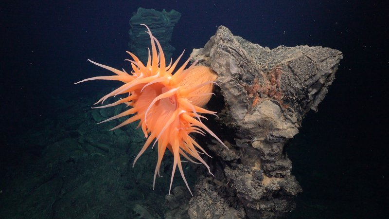
Among the significant findings are 15 species previously unknown to the region, including a mollusk, known as a monoplacophoran or living fossil, and a nursery with eggs of Pacific white rays found in low-temperature hydrothermal vents. This nursery is only the second documented in the world, with a similar one in Canada.
Pioneering mapping technology
Led by Dr. John Jamieson of Memorial University of Newfoundland, Canada, the researchers integrated two groundbreaking sonar technologies (named M3 and InSAS) for high-resolution mapping with a remotely operated underwater vehicle (ROV). These technologies were combined to create detailed maps of the seafloor with a resolution of up to 3 centimeters.
As a point of comparison, the best available ship sonar technologies typically create maps with resolutions ranging from 15 to 50 meters at depths of 1.5 to 3 kilometers.
The highly detailed maps enabled scientists to locate new hydrothermal vents at depths between 1600 and 2400 meters, identifying the chemicals they emit and the animals inhabiting them.
Stuart Banks, Senior Marine Scientist at the Charles Darwin Foundation, stated, "This innovative mapping technology is helping to characterize these unique deep-sea vent ecosystems in detail, and understand how restricted they are to deep hydrothermal areas. It also helps us appreciate how marine life has evolved in darkness and under enormous pressures to thrive in geothermal zones."
Better understanding deep-sea ecosystems for enhanced protection
With the help of this technology, scientists revisited the world's first discovered hydrothermal vent field, "Rose Garden," in the Galapagos Marine Reserve.
A 2002 expedition aboard the R/V Atlantis of the Woods Hole Oceanographic Institution determined that this field became inactive due to a volcanic eruption covering it in lava. In 2015, an expedition aboard the E/V Nautilus revisited the site, collecting evidence of low-temperature venting but couldn't locate the source. The current expedition, equipped with high-resolution maps and acoustic images, successfully completed a comprehensive mapping of this hydrothermal vent field, identifying specific features associated with its hydrothermal evolution.
Dr. Jamieson stated, "We returned to the place where the first hydrothermal emissions were discovered with technology that the original explorers couldn't even dream of. This technology is revolutionizing our ability to explore and characterize these sites in a way unimaginable in the late 1970s. It's like returning to the moon after fifty years but with the latest technology of the 21st century."
The use of high-resolution maps and images not only helped identify known active venting sites that hadn't been explored before, but also led to new discoveries in sites previously studied. The expedition's maps and samples will assist scientists in creating a more comprehensive understanding of the life cycle of hydrothermal vent ecosystems.
Inactive hydrothermal vents are a potential target for deep-sea mining, and the data collected during the expedition will help scientists understand their role on the planet and their significance for dependent animals. Ecuador has requested a preventive pause in deep-sea mining.
"These detailed maps, created with state-of-the-art technology, are exceptional for exploring the area and analyzing the complexity of the seafloor," said Dr. Jyotika Virmani, Executive Director of the Schmidt Ocean Institute. "In addition to increasing scientific knowledge of the region, it's wonderful to know that they will be used in the management of Ecuador's own marine resources. The Schmidt Ocean Institute is committed to developing new technologies that allow us to fully map and characterize the seafloor."
About the expedition
The 30-day expedition, starting on October 24, 2023, was conducted in collaboration with the Galapagos National Park Directorate (DPNG), the Charles Darwin Foundation, and the Oceanographic and Antarctic Institute of the Ecuadorian Navy (INOCAR). Other participating institutions included Memorial University of Newfoundland, University of Victoria, Dalhousie University, University of Ottawa, The Japan Agency for Marine-Earth Science and Technology, The United States Geological Survey, University of Quebec at Romouski, Kraken Robotics, and Fisheries and Oceans, Canada.
-ENDS-
About the organizations
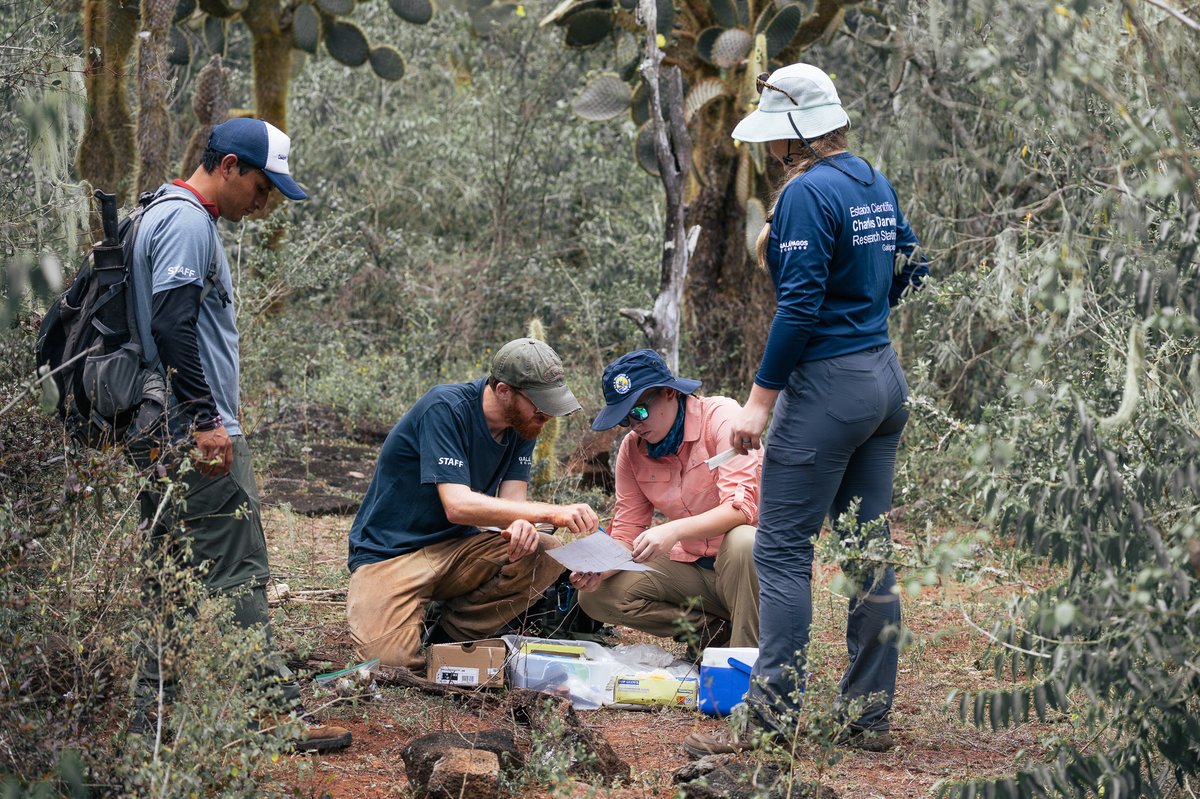
Since 1959, the Charles Darwin Foundation has worked closely with the Galapagos National Park Directorate to protect the natural resources of the islands and share scientific findings for the conservation of this living laboratory. More than a hundred scientists, educators, researchers, support staff, and volunteers from around the world have participated in this effort, with over 75% of the current staff being Ecuadorian citizens. The Charles Darwin Foundation is committed to the professional development of Galapagos residents as future scientists for the well-being of the islands and the nation as a whole.
The Schmidt Ocean Institute, founded in 2009 by Eric and Wendy Schmidt, aims to catalyze the discoveries necessary to understand our ocean, sustain life, and ensure the health of our planet. This is achieved through impactful scientific research, intelligent observation, technological advancements, open information exchange, and public engagement, all at the highest levels of international excellence. For more information, visit www.schmidtocean.org.
The Galapagos National Park Directorate is responsible for conserving the ecological health and biodiversity of the island and marine ecosystems in protected areas. They also ensure the rational use of goods and services generated by the protected areas for the community.
The Oceanographic and Antarctic Institute of the Navy (INOCAR)ute of the Navy (INOCAR) is a technical body of the National Maritime Authority of Ecuador and serves as the National Hydrographic Service. It performs various functions related to hydrography and marine navigation, including hydrographic surveys, chart production, maintenance of navigation aids, monitoring ocean conditions, providing weather forecasts, and issuing tsunami alerts. INOCAR also plays a crucial role in controlling and monitoring oceanographic exploration and research activities to ensure effective execution and alignment with national regulations. For more information, visit: www.inocar.mil.ec.
Memorial University of Newfoundland is one of Canada's leading ocean-related research centers and one of the top 20 research universities in Canada. Memorial is a partner in the Ocean Frontier Institute, a $220 million collaborative research initiative aimed at harnessing the vast potential of the world's oceans. Memorial is also part of Canada's Ocean Supercluster, a private sector-led partnership using innovation and commercialization to drive sustainable economic growth from our oceans
Protect Galapagos, Impact the World
The impact you make on this small ecosystem of enormous biodiversity is part of a larger footprint you are leaving for the world's future. Join us on our mission to safeguard one of our planet’s most important natural treasures through science and conservation action by making a donation today. Thank you for making an impact with us.