Macarena Parra
"Try to be like the turtle, at ease in your own shell." Bill Copeland
Humans are one of the most evolved and rational beings on Earth, but there are some things that we can learn. In this blog I’m going to share with you a retrospective analysis of a fantastic and simple life.
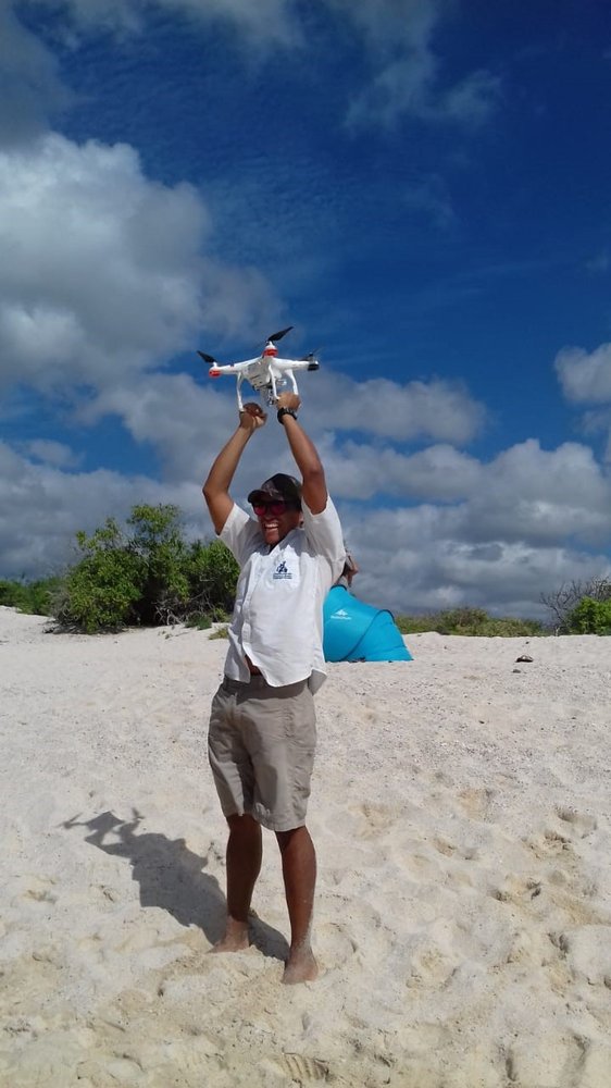
Since 2016 I have been operating drones. Having this experience means I can use this technology in several projects at the Charles Darwin Foundation (CDF).
On this occasion, I am going to tell you about my experience from the sea turtle project. At the beginning of 2020, we worked on the CDF sea turtles' project intending to obtain information about green turtles (Chelonia mydas) using Unmanned Aerial Vehicles (UAVs). This technology lets us acquire aerial images and panoramic videos, to estimate the number of turtles under certain conditions (i.e. year season, habitat, etcMy experience collaborating with the research and conservation of the Galapagos sea turtle..) in a specific place.
In the first semester of the 2020, I had the privilege of being the drone pilot for this project. We visited two aggregation sites of the species: Las Bachas Beach and Tortuga Bay Mansa Beach.
Las Bachas is an annidation beach for the green turtle on the north of Santa Cruz Island, and Tortuga Bay Mansa Beach is a feeding and resting site placed in the south-west of the same island. Both sites are important because they are iconic tourism places on Santa Cruz island.
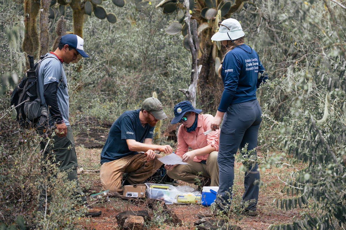
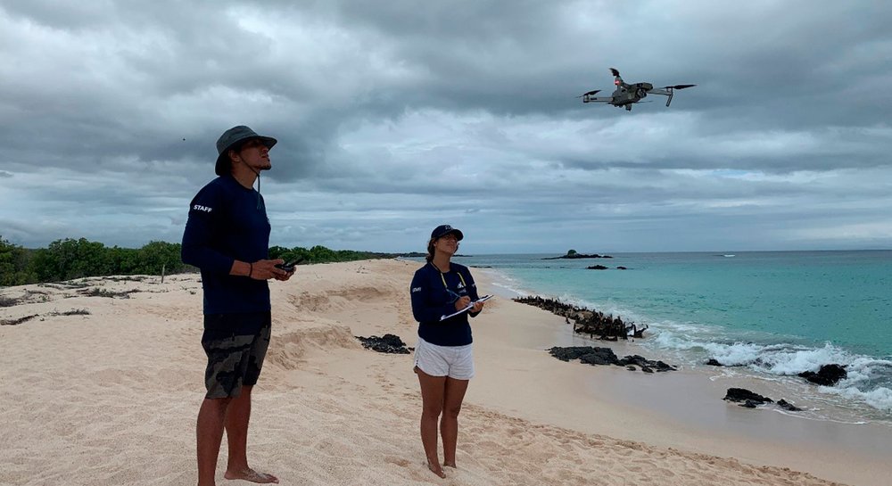
At Bachas, we made some drone flights in front of the annidation beach, but also we installed tracking and monitoring devices in some nesting female green turtles. This activity is performed at night. I had the opportunity to join my co-workers on this task. On this field, we counted with the support of experienced rangers of the Galapagos National Park Directorate (GNPD), who generously hosted us on their camp set up on the beach. Every year, this site is used as a field base for the monitoring of nesting turtles.
We arrived at Las Bachas around 16:00 hrs. After unloading the boat all the backpacks, camping tents, and research equipment, we set up the base camp. The dress code for the night job, because of the natural conditions of the place (hungry mosquitoes, cold sea breeze, walks on sand and lava rocks, among others), was long pants, long sleeve shirt, buff, socks, and hiking shoes. The search for sea turtles and installing the devices started at 19:00 hrs and it last until first light.
The walk along the coastline is around 2 km, where the harmonious noise of the waves, the starry nights, and the occasional chats with your monitoring partner, makes the hours fly. When a turtle goes up to the beach for leaving its eggs at the dunes; these are the moments when we had to be more precocious. We hide from them, because they are very shy, especially when they came out of the water. Without losing her sight, we waited until the site where the turtle starts to dig its nest. Once the nesting process is finished, and the turtle is resting; the researchers check the turtle shell to remove the tracking device or to install a new one.
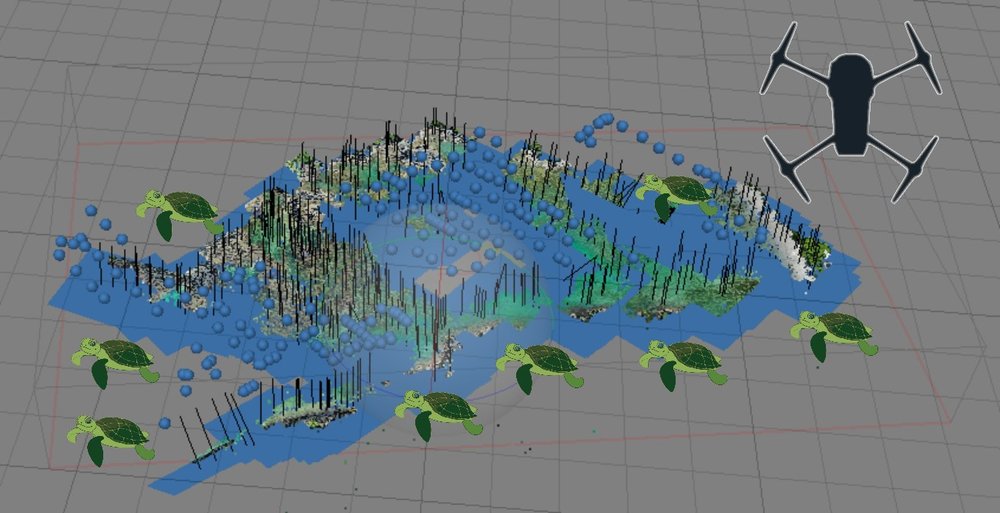
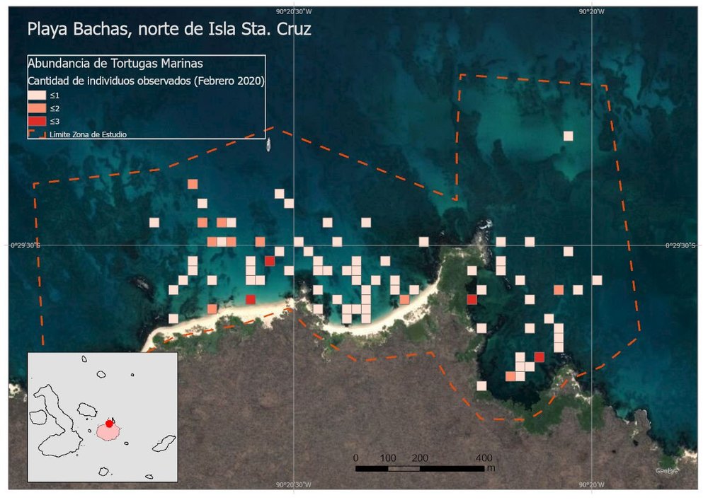
All this fieldwork and participation in the monitoring activities of sea turtles combines a mix of beautiful landscapes, turtles watching, some nights were lucky enough to see shooting stars. After the monitoring, around five o’clock in the morning, I went back to the camp with enough time to prepare the drone, and enjoy a cup of coffee to achieve the task of the aerial survey in front of the nesting site properly. The survey was formed by 4 flights of 16 minutes approximately, where we draw the flight lines that covered the study site at the nesting beach to register the presence of sea turtles in the high-resolution images captured (Figure 2.).
Back to the office
After 4 days, when I get back to the Charles Darwin Research Station (CDRS), I’m able to work with the field-based information (aerial images and panoramic flights). With the aid of computational technics of remote sensing with a drone, I can edit the photos (order, bright, exposition, etc.), organize them per flight, georeferentiation, and I got a mosaic of the survey images.
Byron Delgado
To count the number of sea turtles on the site of each flight, I analyzed a natural color combination and shapes of pixels assisted on the screen photo software (blue squares Figure 2.)
Then the registration of the presence of the species. For this, I used the mosaic and check each of the photos (900 photos per flight approximately). Each time that I detected a sea turtle in an image, I marked the geographic position (black vertical line in Figure 2.) on the mosaic. This permitted to obtain a map to show the abundance of sea turtles in front of the nesting beach (Figure 3.). The result is shown on a range of 8 to 10 individuals in the drone survey in the mentioned trimester.
Byron Delgado
I want to highlight the importance of this technology which has now become a research tool to support natural conservation, especially in the Galapagos. With the help of the drone, it is possible to get to places where the logistics would be very expensive or even inaccessible. This technology allows us to gather information with a minimal disturbance to the study site, the gathered data is of very high resolution and quality. This data is managed with new computational techniques, that consequences in the right information to decision-makers.
Finally, it is imperative to show the important of these ecosystems of the study sites for the sea turtles.
I can’t stress the importance of these study sites for the sea turtle. We have to control the activities that take place near and on these sites such as: daily visits by tourists, several big and little boats, all of this must be managed correctly to diminish the impacts on these sites.
We would like to thank the “Agisoft Metashape Professional V. 1.5.2” for the donation of a license of the software to image processing and the donors that made possible this project. Mr. Eugene Chuang and Mrs. Karen Lo, IGTOA and Galapagos Conservancy Canada.
A special thanks to the Galapagos National Park that helped us in the activities, and to my CDF co-workers Macarena Parra (project leader) and Diana Loyola (field assistant) because of their invitation to be part of this research field experience and to Queen´s University Belfast which is the main partner in this research.
-ENDS-
Diana Loyola
Byron Delgado
GIS Researcher
Protect Galapagos, Impact the World
The impact you make on this small ecosystem of enormous biodiversity is part of a larger footprint you are leaving for the world's future. Join us on our mission to safeguard one of our planet’s most important natural treasures through science and conservation action by making a donation today. Thank you for making an impact with us.